|
WILDFLOWER TRAIL
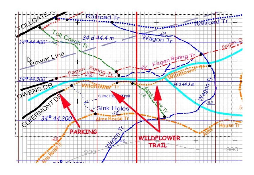
Approximately 0.3 miles from the Cleermont Trail head there is a junction with the AlmsCreek Trail. A large sign
marks this junction. The Alms Creek Trail also connects uphill to the Alms House (3 Caves) Trail. Sorry about the similar and confusing trail names but this what the signs say.
The Wildflower Trail continues on east past the fork in Fagan Creek and up the South Fork a short distance. The
Wildflower trail then crosses the South Fork of Fagan Creek and then follows the main Fagan branch to the Wagon
Trail Intersection. There are Trail Signs here. This is the end of the Wildflower Trail. From here, you can return to
the Cleermont Trail head via the Wildflower Trail are take any of the numerous trails to visit other places of the
Huntsville Land Trust.
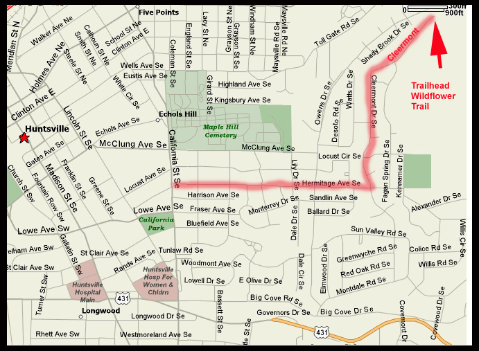
DIRECTIONS: From California, take Hermitage East to Cleerment, then continue on Cleermont to dead end. There is a small parking place. See Wildflower Access and detailed trail links below. Also,
Check the Land Trust Web site at http://www.landtrust-hsv.org/ for the wildflower and nature hikes that they sponsor. |