|
Huntsville Land Trust
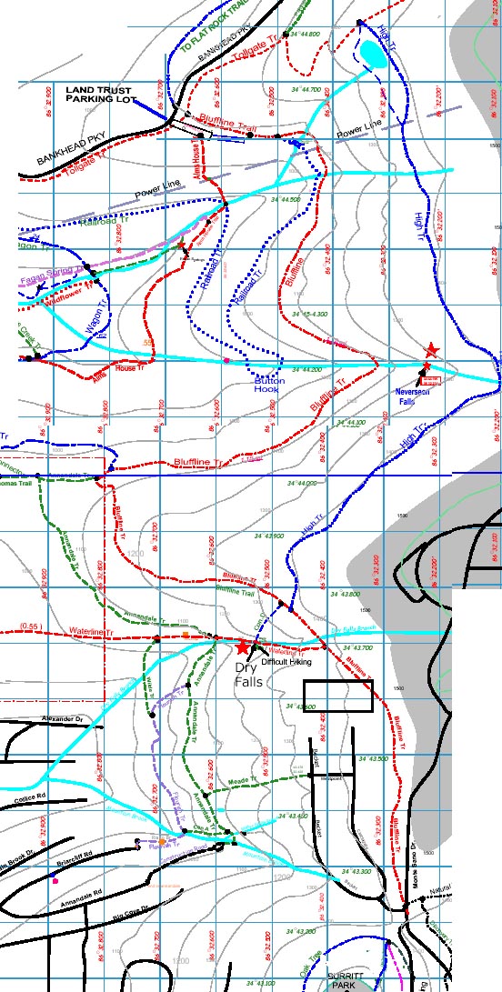
Access is near the entrance gate of the HLT parking lot (uphill side) The sign will say Tollgate Trail, but in a few feet you will reach the Tollgate/Bluffline Junction A Large HLT sign provides direction information. The trail is marked at frequent intervals by HLT diamond markers on trees. After 0.3 miles, the Bluffline/Railroad Junction is reached Proceeding on the Bluffline, the trail generally runs southerly and roughly follows the 1100 ft contour. After about .5 miles, the trail crosses the South Fork of Fagan Creek, then runs generally west. After another half mile, junctions with other trails are reached. Consult a map for their destinations and combinations for a loop back to the parking lot.
For those continuing on the Bluffline, bypass the junctions and follow the trail around a horseshoe bend and start climbing. The trail is rocky in places. After about .5 miles the junction with the High Trail is reached, marked by a large HLT sign. Elevation 1300 feet. The High Trail can be used for return to the HLT Parking lot.
After the High Trail Junction, The Bluffline Trail descends steeply and then climbs again to the Waterline Trail Junction. Elevation 1400 feet. There is a HLT sign here also. The Waterline Trail can be taken down hill in a westerly direction to the 3 Caves areas. The Waterline Trail has a very difficult section in passing Dry Falls. From the Waterline Trail Junction, The Bluffline Trail proceeds on up the mountain, past the recent landslide area, and finally to Monte Sano Blvd, just north of the entrance to Burritt Museum Elevation 1500 feet. Trail intersections include, Railroad Bed, Wagon, Annandale, and High. A one-way or round trip hike of the Bluffline is a fine adventure.
|